Good news for aviation fans! Recently, the 15th China International Aviation and Aerospace Exhibition held in Zhuhai has been dominating the headlines!
 The 15th China International Aviation and Aerospace Exhibition opens in Zhuhai (Photo source: People's Navy WeChat official account)
As one of the world's five most internationally influential airshows, the Zhuhai Airshow has always been full of "technology and hardcore innovation." This edition is even more impressive, with a host of "major national heavyweights" in the aviation and aerospace field unveiled in a concentrated display, bearing witness to the capacity for leapfrog development. The flying displays were unprecedented in scale, with the J-16, J-20, and J-35A flying together for the first time, and the J-35A performing a "loop" on its debut. The Russian "Warriors" aerobatic team and the Chinese Air Force's "August 1st" and "Red Eagle" aerobatic teams performed together on the same stage... a dazzling spectacle too wonderful to take in all at once.
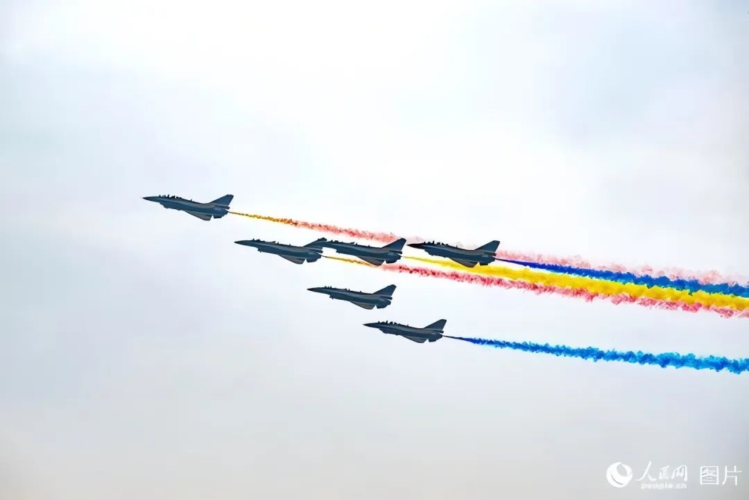 The Air Force August 1st Aerobatic Team performs a flying display (Photo source: People's Daily Online)
Actually, when it comes to aircraft, people often picture the airliners of carriers such as Air China and China Eastern soaring across the skies, shuttling through the blue skies and white clouds around the world as "bridges in the air." And when it comes to geology, many may associate it with "scratching a living from the soil," picturing geologists with a geological hammer in the left hand and a compass in the right, facing the loess with their backs to the sky.
However, few people know that the geological field actually has its own aircraft.
But these special aircraft are not used to carry passengers or cargo; instead, they are equipped with precision geological exploration instruments, dedicated to conducting efficient and accurate geological exploration in the vast skies. Like eyes in the sky, they reveal to geologists key information such as the Earth's internal structure, the distribution of mineral resources, and geological hazard risks.
Today, let us step into the little-known world of geological aircraft, lift their mysterious veil, and explore their wide application and unique charm in the field of geological exploration.
The "Aviation Geology No. 1" medium- and long-range fixed-wing airborne geophysical and remote sensing professional survey aircraft
The first to appear is a well-deserved heavyweight "guest"—it has "measured the height" of Mount Everest and "taken photographs" of Mount Everest! This is the "Aviation Geology No. 1" aircraft, known as the "Chinese Geological Survey Air Force" and affiliated with the China Geological Survey under the Ministry of Natural Resources.
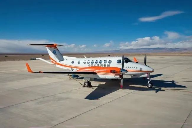
How tall is Mount Everest exactly? To answer this question, one must first clarify the elevation datum—in plain terms, where the zero-meter sea level at the foot of Mount Everest lies. Just as we measure height starting from the soles of the feet, the height of a mountain must also be measured from its "soles."
When we look at Mount Everest with our eyes, the "height we see" is not actually its true height, because the Earth is an ellipsoid, and the starting point of your line of sight is the point beneath your feet, not the point at the foot of Mount Everest.
So where are the "soles" of Mount Everest? This requires the concept of the geoid. The geoid is an important physical reference surface describing the shape of the Earth—that is, the datum surface from which the elevation system is calculated. Accurately determining this level surface is equivalent to finding the "soles" of Mount Everest.
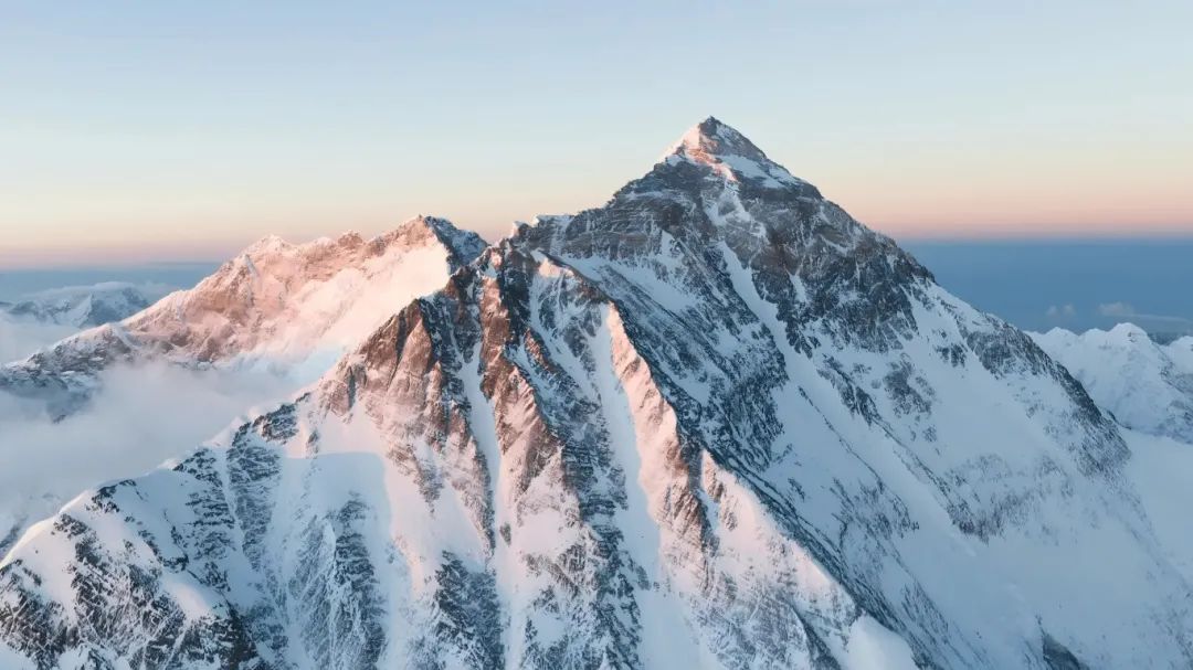
Airborne gravity data can be used to calculate the geoid more accurately, and airborne remote sensing data can be used to obtain a three-dimensional digital terrain model more accurately. In the 2020 Mount Everest elevation measurement mission, the aerial survey tasks for which the "Aviation Geology No. 1" aircraft was responsible included airborne gravity measurement and remote sensing measurement, enabling it to obtain key data on Mount Everest's elevation quickly, efficiently, and with high precision.
In addition to "measuring the height" of Mount Everest, the "Aviation Geology No. 1" aircraft can also fly higher than Mount Everest and use three sets of special "lenses" to capture from the air a set of panoramic high-definition photographs of Mount Everest, each single frame reaching up to hundreds of millions of pixels.
The renowned "Aviation Geology No. 1" aircraft specializes in airborne geophysical and remote sensing surveys in high-mountain and plateau regions, and can conduct airborne gravity, magnetic, photographic (oblique, push-broom, frame), hyperspectral, LiDAR, and other flight measurements.
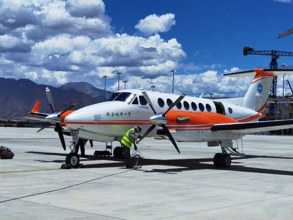
So what exactly is the "background" of such an impressive aircraft? Records show that the "Aviation Geology No. 1" aircraft was modified and designed by the Natural Resources Airborne Geophysics and Remote Sensing Center of the China Geological Survey, and was converted from a King Air 350ER aircraft. Internationally, the King Air 350ER is generally modified only for a single airborne geophysical professional survey or a single remote sensing professional survey; the "Aviation Geology No. 1" was modified for integrated airborne geophysical and remote sensing geological surveys, and two remote sensing windows were added, greatly improving the aircraft's efficiency and truly achieving geophysical and remote sensing measurements on the same aircraft, at the same time, with multiple parameters.
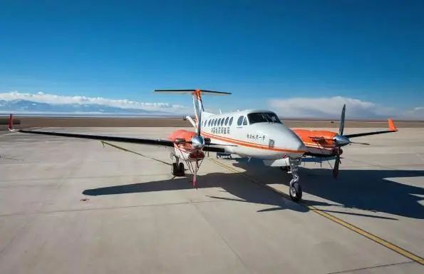
And that's not all! The "Aviation Geology No. 1" also features an advanced flight measurement platform widely adopted internationally, with a twin-engine pressurized configuration. Its small-to-medium fuselage makes it fuel-efficient and environmentally friendly; in addition, it offers the advantages of safe, stable low-altitude and low-speed flight and wide applicability. Its flight ceiling reaches 10,558 meters, and it can operate freely in extreme cold down to -40°C and heat up to 50°C. It can also complete operations under complex meteorological conditions such as sand and dust, humid heat, salt fog, and day and night!
The "Aviation Geology No. 1" aircraft is truly extraordinary!
The "Aviation Geology No. 2" medium-sized airborne geophysical and remote sensing professional survey helicopter
Next to appear is the "Aviation Geology No. 2" aircraft, which can conduct airborne gravity, magnetic, towed-bird electromagnetic, and radiometric surveys, as well as LiDAR and various aerial photography flight measurements.
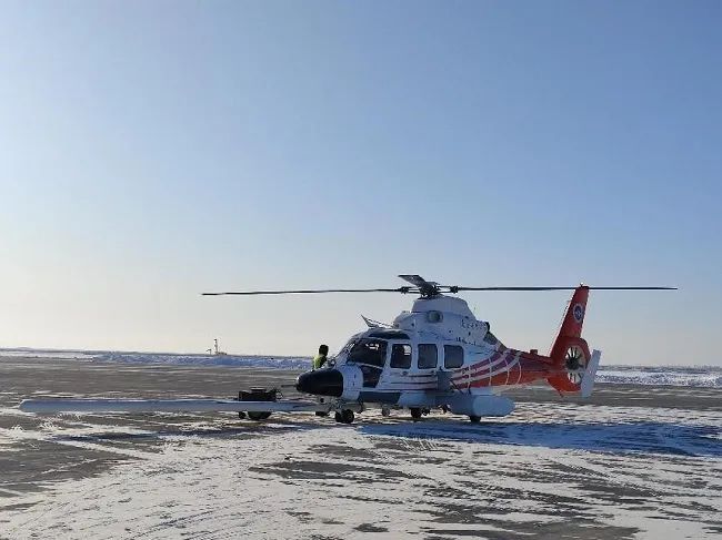
So what is its "background"? Records show that the "Aviation Geology No. 2" medium-sized airborne geophysical and remote sensing professional survey helicopter was converted from an AC312E medium helicopter, with the fuselage produced by AVIC Harbin Aircraft Industry Group Co., Ltd.; it is an upgraded product based on the original Z-9 helicopter.
The "Aviation Geology No. 2" helicopter is an internationally advanced professional airborne geophysical and remote sensing measurement platform. It can meet all the airborne geophysical survey method requirements of the Natural Resources Airborne Geophysics and Remote Sensing Center—aeromagnetic, airborne electromagnetic, airborne radiometric, and airborne gravity—and in particular has been fitted with a generator with a power supply capacity of 300 A, which can meet the time-domain airborne electromagnetic measurement equipment's requirements for high-current transmission and large detection depth. At the same time, a mounting fixture for a small aerial camera has been added, enabling geophysical and remote sensing measurements on the same aircraft, at the same time, with multiple parameters.
Its flight altitude can reach 5,200 meters, lower than the "Aviation Geology No. 1" aircraft, but it is equally formidable: it can operate freely in extreme cold down to -40°C and heat up to 50°C. In addition, it can complete operations under complex meteorological conditions such as sand and dust, humid heat, salt fog, and day and night!
Simply a must-have for surveying and a superb flying tool!
The "Aviation Geology No. 3" small airborne geophysical and remote sensing professional survey helicopter
Next up is the "Aviation Geology No. 3" small helicopter. Compared with its "big brother" and "second brother," it is somewhat smaller in size and belongs to the small helicopter class. It was converted from an AC311A small helicopter, with the fuselage produced by AVIC Changhe Aircraft Industry Co., Ltd.; it is a finalized product improved on the basis of the original AC301 and AC311 models.
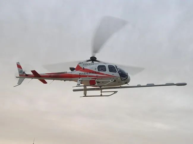
The "Aviation Geology No. 3" small helicopter is a newly developed domestically leading small professional survey flight platform with good high-altitude performance. Its basic performance is comparable to the French Squirrel B3 helicopter, which is currently imported and used in large numbers in China, placing it at the domestic leading and internationally advanced level.
Its flight altitude can reach 6,500 meters, and it can still operate freely in extreme cold down to -40°C and heat up to 50°C. However, it is better suited to operating under environmental conditions such as sand and dust, humid heat, and high altitude.
Although its "build" is more compact, its contribution is no less!
The Pegasus F1000 UAV equipped with a UAV remote sensing system
In addition to the three high-profile "heavyweight guests" above, there are other small UAVs used in various environments and mines. In geological exploration, they can be used for topographic mapping, mineral exploration, geological hazard monitoring, and more, efficiently covering large areas and acquiring high-precision terrain data, providing important references for geological exploration.
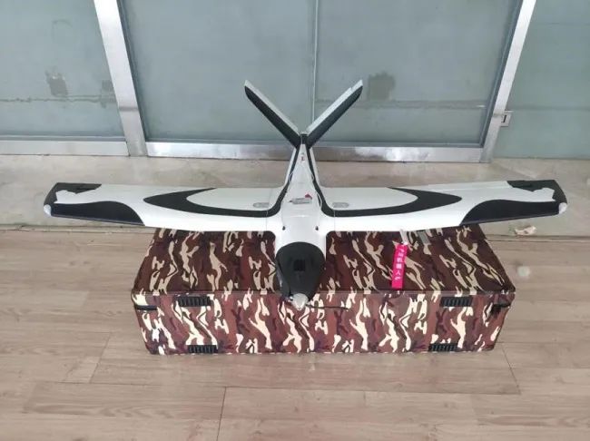
The first to introduce is the Pegasus F1000 UAV equipped with a UAV remote sensing system. The entire aircraft is made of EPO and carbon fiber composite materials, making it light and sturdy; the wings, tail, parachute bay, and battery bay all use quick-assembly structures that can be disassembled and assembled by a single person without tools. It features fully intelligent flight and includes a one-stop aerial survey software solution, supporting single-person aerial survey operations with simple and convenient operation.
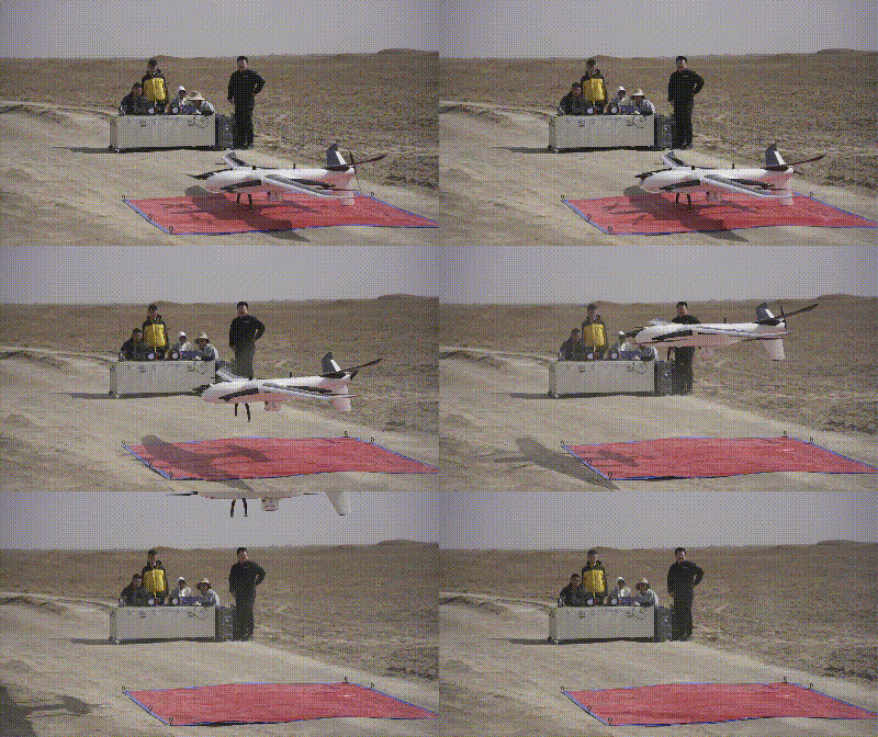
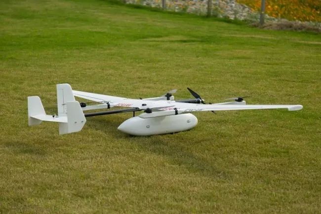
There is also the vertical take-off and landing UAV (CW-15), which uses a purely electric VTOL fixed-wing UAV system capable of vertical take-off and landing and fully autonomous flight, with simple operation; it is equipped with multiple mission module bays that can carry mission payloads according to actual needs; the fuselage structure is highly modular, with all connection structures using quick-lock devices; the rotor arms use a folding design and need not be disassembled, with electrical and mechanical connections synchronized in one step, further improving reliability and convenience.
In addition, we also have a variety of geological UAVs with different functions, each with its own characteristics to meet different exploration needs—we won't introduce them one by one here. These geological aircraft, helicopters, and UAVs not only embody technological progress but are also indispensable "aerial sharp weapons" in the field of geological exploration.
Shenzhen-Zhongshan Link: Innovation Builds a Mega Project (Science & Technology Perspective · Bravely Serving as a Vanguard of High-Level Scientific and Technological Self-Reliance)
下一篇Orient Geophysical's Overseas Deepwater ROV Seismic Acquisition Project Successfully Concludes

2026-09-28 1157 0
2026-09-24 10586 0

2026-09-23 10714 0

2026-09-22 10808 0

Lize City Air Terminal Underground Main Structure Nearing Completion: Maximum Transfer Walk Under 4 Minutes After Operation

Anti-seepage Curtain for Main Lock Pit of CSCEC Port Shenqiu Double-Line Lock Project Completed on Schedule

All Pile Foundations Completed on Quanzhou Baiqi Channel

Hainan Upgrades Housing and Municipal Infrastructure
First Foundation Concrete Pour Successfully Completed for Zambia Kafue West–Muzuma 330kV Transmission Line EPC Project
Hot News

评论 (0)